
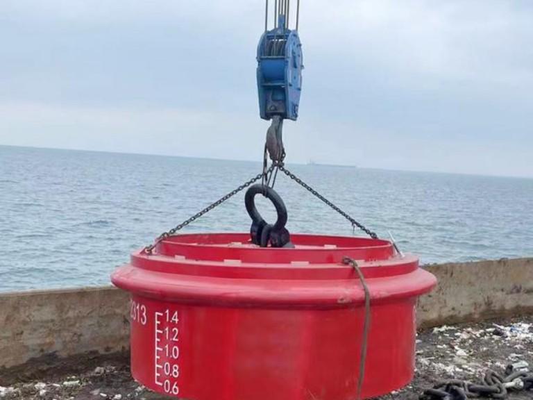
Buoys are floating devices anchored to the seabed. They guide ships through safe channels and warn of underwater hazards. Every crew member must understand what these markers mean. A misread buoy can lead a vessel into shallow water, rocks, or restricted zones.
As a professional marine equipment manufacturer, Zhonghaihang Shipping Supply is dedicated to designing and manufacturing a wide range of marine protection equipment for ports and vessels worldwide. Our products, such as pneumatic fenders, rubber fenders, and foam fenders, operate with buoy systems to protect ships and port infrastructure while they are docking.
Understanding the IALA Buoyage System
Before learning individual buoy types, you need to understand the system behind them.
The International Association of Marine Aids to Navigation and Lighthouse Authorities (IALA) maintains a standardized buoyage system. This system is used across the globe. However, it is divided into two regions with one critical difference.
- IALA Region A: Region A covers Europe, Africa, Asia (except Japan, South Korea, and the Philippines), Australia, and most of the rest of the world. In this region, red marks are on the port (left) side of the channel when entering from seaward. Green marks are on the starboard (right) side.
- IALA Region B: Region B covers North America, Central America, South America, Japan, South Korea, and the Philippines. In this region, the colors are reversed. Red marks are on the starboard (right) side of the channel when entering from seaward. Green marks are on the port (left) side. This is the origin of the well-known rule: “Red, Right, Returning.”
Why This Matters: If a ship travels from a Region A port to a Region B port, the crew must adjust how they read lateral buoys. Failing to do so is a serious safety risk. Cardinal buoys, isolated danger marks, and safe water marks remain the same in both regions.
Lateral Buoys
Lateral buoys mark the edges of navigable channels. They are the most common type of buoy that mariners encounter.
Port Hand Buoys
Port hand buoys mark the left side of the channel as a vessel enters from the open sea.
In IALA Region A:
- Color: Red
- Shape: Can (cylindrical) or pillar
- Light: Red (if fitted)
- Topmark: Red can shape
In IALA Region B:
- Color: Green
- Shape: Can (cylindrical)
- Light: Green (if fitted)
- Number: Odd numbers (1, 3, 5…)
When traveling upstream or returning to port, keep port hand buoys on your left side.
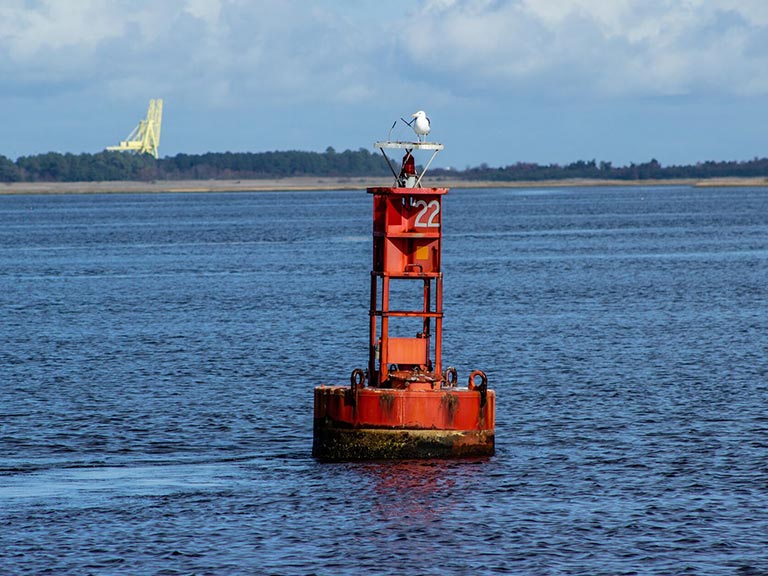
Starboard Hand Buoys
Starboard hand buoys mark the right side of the channel as a vessel enters from the open sea.
In IALA Region A:
- Color: Green
- Shape: Conical or pillar
- Light: Green (if fitted)
- Topmark: Green cone, point up
In IALA Region B:
- Color: Red
- Shape: Conical (nun buoy)
- Light: Red (if fitted)
- Number: Even numbers (2, 4, 6…)
When traveling upstream or returning to port, keep starboard hand buoys on your right side.
Preferred Channel Buoys
At channel junctions, preferred channel buoys indicate which route is the main channel. These buoys have horizontal bands of red and green. The top band color tells you which channel is preferred.
- Top band red → Preferred channel is to port (treat as a port hand mark)
- Top band green → Preferred channel is to starboard (treat as a starboard hand mark)
Cardinal Buoys
Cardinal buoys indicate where the deepest or safest water lies relative to a hazard. They use the four compass directions: North, South, East, and West. Their color scheme is always black and yellow.
Cardinal buoys look the same in both IALA Region A and Region B.
North Cardinal Buoy
- Topmark: Two black cones, both pointing up (▲▲)
- Color: Black on top, yellow on the bottom
- Light: White, continuous quick flash (Q) or very quick flash (VQ)
- Meaning: Safe water is to the north. Pass north of this buoy.
Memory aid: Both cones point UP → North is up on a compass.
South Cardinal Buoy
- Topmark: Two black cones, both pointing down (▼▼)
- Color: Yellow on top, black on bottom
- Light: White, 6 quick flashes + 1 long flash (Q(6)+LFl or VQ(6)+LFl)
- Meaning: Safe water is to the south. Pass south of this buoy.
Memory aid: Both cones point DOWN → South is down on a compass. Six flashes = 6 o’clock = south.
East Cardinal Buoy
- Topmark: Two black cones, base to base (▲▼)
- Color: Black with a single yellow horizontal band in the middle
- Light: White, 3 quick flashes (Q(3) or VQ(3))
- Meaning: Safe water is to the east. Pass east of this buoy.
Memory aid: Cones form a shape wide in the middle, like the letter “E” turned sideways. Three flashes = 3 o’clock = east.
West Cardinal Buoy
- Topmark: Two black cones, point to point (▼▲)
- Color: Yellow with a single black horizontal band in the middle
- Light: White, 9 quick flashes (Q(9) or VQ(9))
- Meaning: Safe water is to the west. Pass west of this buoy.
Memory aid: Cones form a “W” shape when viewed from the side. Nine flashes = 9 o’clock = west.
Isolated Danger Buoys
An isolated danger buoy marks a small, specific hazard with navigable water all around it. Examples include a single rock, a small shoal, or a sunken wreck.
- Color: Black with one or more red horizontal bands
- Topmark: Two black spheres, one above the other (●●)
- Light: White, group flashing two (Fl(2))
- Shape: Pillar or spar
The buoy is placed directly on or above the danger. Vessels may pass on any side, but should not approach too closely.
Safe Water Marks
Safe water marks indicate that there is navigable water all around the buoy. They are commonly used to mark the center of a channel, a mid-channel point, or a landfall approach.
- Color: Red and white vertical stripes
- Topmark: Single red sphere (●)
- Light: White, isophase (Iso), occulting (Oc), or long flash every 10 seconds (LFl 10s)
- Shape: Spherical, pillar, or spar
Vessels may pass on either side of a safe water mark. These buoys are identical in both IALA regions.
Special Marks
Special marks are not primarily used for navigation. They indicate special areas or features such as:
- Anchorage zones
- Recreational areas
- Traffic separation boundaries
- Cable or pipeline routes
- Military exercise areas
- Ocean data acquisition systems (ODAS)
Characteristics:
- Color: Yellow
- Topmark: Single yellow “X” shape
- Light: Yellow (any rhythm not used for other marks)
- Shape: Optional — can be any shape not conflicting with lateral or cardinal marks
Emergency Wreck Marking Buoys
This buoy type was introduced by IALA to provide immediate marking of new, uncharted wrecks. It is typically deployed within the first 24–72 hours after a wreck occurs.
- Color: Blue and yellow vertical stripes
- Topmark: Yellow cross (+)
- Light: Alternating blue and yellow flashing (Fl BU Y)
- Shape: Pillar or spar
This buoy stands out from all other buoy types by design. Its unique color combination ensures that mariners do not confuse it with existing marks.

Mooring Buoys
Mooring buoys provide a fixed floating point where vessels can tie up without anchoring. This protects the seabed — especially in areas with coral reefs or sensitive habitats — from anchor damage.
Common characteristics:
- Color: Typically white, or white with a blue horizontal band
- Shape: Spherical, cylindrical, or barrel-shaped
- Features: Pickup line, hawsing ring, or mooring eye on top
Mooring buoys are widely used in harbors, marinas, and environmentally protected areas.
Anchorage Buoys
Anchorage buoys define the boundaries of an area where vessels are permitted to anchor. They mark the perimeter of the anchorage zone — not a specific anchoring spot.
- Color: Yellow (classified as a special mark in the IALA system)
- Shape: Varies
- Light: Yellow (if fitted)
Always check nautical charts for water depth and bottom conditions before anchoring within a designated area.
Regulatory and Informational Buoys
In many inland and recreational waterways, additional buoys communicate rules and warnings. These are common in the United States and other countries with extensive inland waterway systems.
- Color: White with orange markings
- Shapes on the buoy indicate different messages:
- Open diamond → Danger
- Diamond with cross → Exclusion area (do not enter)
- Circle → Operating restriction (e.g., speed limit)
- Square or rectangle → General information
These markers are separate from the IALA system and are maintained by local authorities.
Specialized and Scientific Buoys
Beyond navigation, buoys serve critical roles in science, weather monitoring, and military operations.
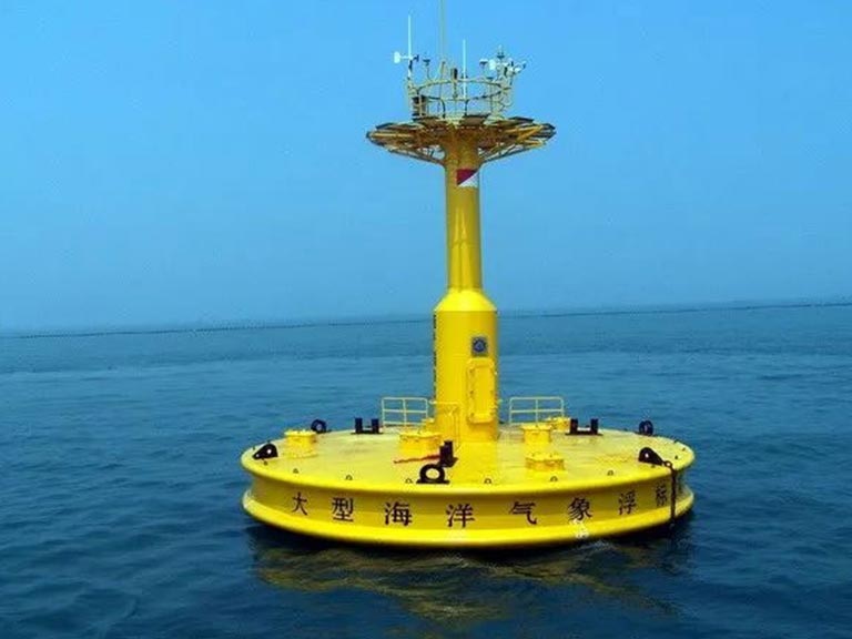
Weather Buoys
Weather buoys collect real-time data on wind speed, air temperature, barometric pressure, wave height, and water temperature. This data is transmitted via satellite to meteorological centers for forecasting.
There are two main types:
- Moored weather buoys: Anchored in fixed positions for long-term monitoring.
- Drifting buoys: Move with ocean currents to track temperature and salinity patterns across large areas.
NOAA’s National Data Buoy Center (NDBC) maintains an extensive network of weather buoys. Their data is publicly available and used by port operators, shipping companies, and researchers worldwide.
Wave Buoys
Wave buoys measure wave height, period, and direction. This information helps port authorities decide whether to allow vessel operations during rough weather.
Tsunami Detection Buoys
These specialized buoys use deep-ocean pressure sensors to detect sudden changes in water pressure. They form a key part of tsunami early warning systems in the Pacific and Indian Oceans.
Research Buoys
Research buoys collect oceanographic data for scientific studies. Applications include tracking marine mammal movements, monitoring ocean acidification, and measuring deep-sea currents.

How to Read Buoy Markings: A Quick Reference
When approaching any buoy, check these four characteristics in order:
- Color — Identifies the buoy type and which IALA system applies.
- Shape — Confirms the type (can, conical, spherical, pillar).
- Topmark — Provides additional identification, especially for cardinal and danger marks.
- Light pattern — Essential for night navigation. Each buoy type has a distinctive flash rhythm.
Common Mistakes to Avoid
- Assuming all countries use the same system. IALA Region A and Region B reverse port/starboard colors. Always check which region you are operating in.
- Relying on color alone. Faded paint, poor visibility, or color blindness can cause errors. Cross-check with shape, topmark, and chart data.
- Treating buoys as fixed reference points. Buoys can shift from their charted positions due to storms, currents, or equipment failure. Always verify with nautical charts and electronic navigation systems.
- Ignoring light characteristics. At night, the flash pattern is often the only way to identify a buoy. Learn the basic rhythms: quick flash, group flash, long flash, and isophase.
Buoy Marking Summary Table
| Buoy Type | Color | Topmark | Light Color | Light Pattern |
|---|---|---|---|---|
| Port Hand (IALA A) | Red | Red can | Red | Any rhythm |
| Starboard Hand (IALA A) | Green | Green cone ▲ | Green | Any rhythm |
| Port Hand (IALA B) | Green | Green can | Green | Any rhythm |
| Starboard Hand (IALA B) | Red | Red cone ▲ | Red | Any rhythm |
| North Cardinal | Black over yellow | ▲▲ | White | Q / VQ |
| South Cardinal | Yellow over black | ▼▼ | White | Q(6)+LFl |
| East Cardinal | Black-yellow-black | ▲▼ | White | Q(3) / VQ(3) |
| West Cardinal | Yellow-black-yellow | ▼▲ | White | Q(9) / VQ(9) |
| Isolated Danger | Black with red band(s) | ●● | White | Fl(2) |
| Safe Water | Red & white vertical stripes | ● | White | Iso / Oc / LFl 10s |
| Special Mark | Yellow | X | Yellow | Any (not conflicting) |
| Emergency Wreck | Blue & yellow vertical stripes | + (yellow) | Blue/Yellow | Alt Fl BU Y |
Why Buoy Knowledge Matters for Marine Operations
Understanding buoys is not just a concern for navigators. Port engineers, fender system designers, and marine equipment installers all benefit from buoy literacy.
When Zhonghaihang engineers arrive at a port for a fender installation project, they must navigate the local buoyage system. Cardinal buoys may mark construction zones around new berths. Lateral buoys define the approach channels where fender placement must align with vessel traffic flow. Special marks may indicate cable routes that affect anchoring decisions during offshore fender deployment.
This is why we believe that sharing maritime knowledge benefits the entire industry. A safer port is a more efficient port — and that is good for everyone.
Need marine protection equipment for your port or vessel? Zhonghaihang offers a complete range of rubber fenders, pneumatic fenders, foam filled fenders, and marine airbags. Contact our team for expert advice and competitive pricing.
Frequently Asked Questions
What is the difference between IALA Region A and Region B?
What is a cardinal buoy and how do I read it?
What is the difference between a buoy and a beacon?
What should I do if I see a buoy that does not match my chart?
Does Zhonghaihang manufacture buoys?
Talk to our team.
Share a few details about your project — vessel, port, or operation. We'll reply within 24 hours.